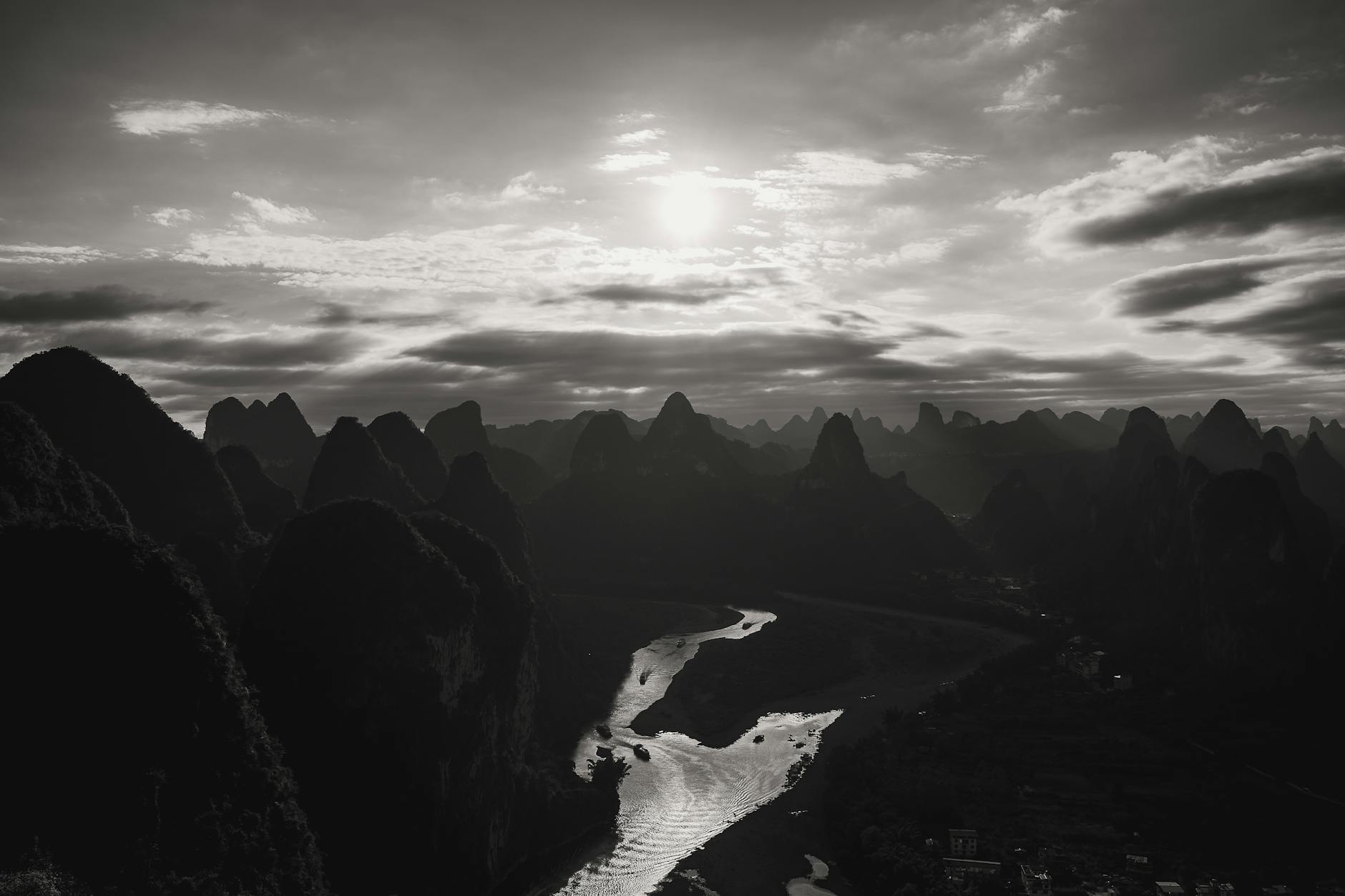
Sunrise viewpoint above the Li River’s most-photographed S-bend — 30 min uphill hike from Xingping town, photographers wake at 4 AM for this.
At a glance
- What it is
- Outdoors
- Also known as
- 相公山 (Xiànggōng Shān)
- Opening hours
- 4 AM – 6 PM
- Time needed
- 2-3 hours
- Best time to visit
- Sunrise 5:30-7 AM April-October; foggy post-rain mornings best
- Getting there
- Taxi / DiDi from metro
- English
- Some English signage
- Cards accepted
- Cash only
- Entry
- Walk-in — no booking
- Wi-Fi
- No public Wi-Fi
- Address
- Xianggong Hill, Xingping Town, Yangshuo County · 桂林市阳朔县兴坪镇相公山
Xianggong Hill map & getting there
Taxi / DiDi? Show the driver: 桂林市阳朔县兴坪镇相公山 · Xianggong Hill, Xingping Town, Yangshuo County
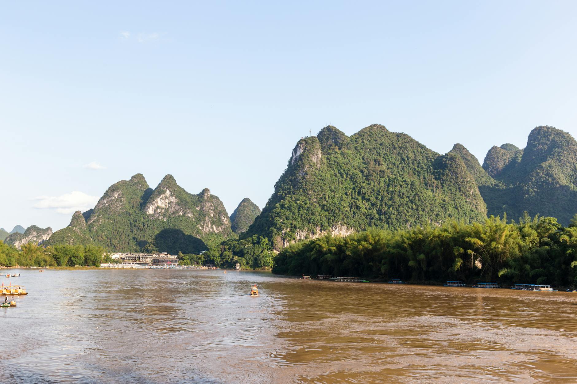
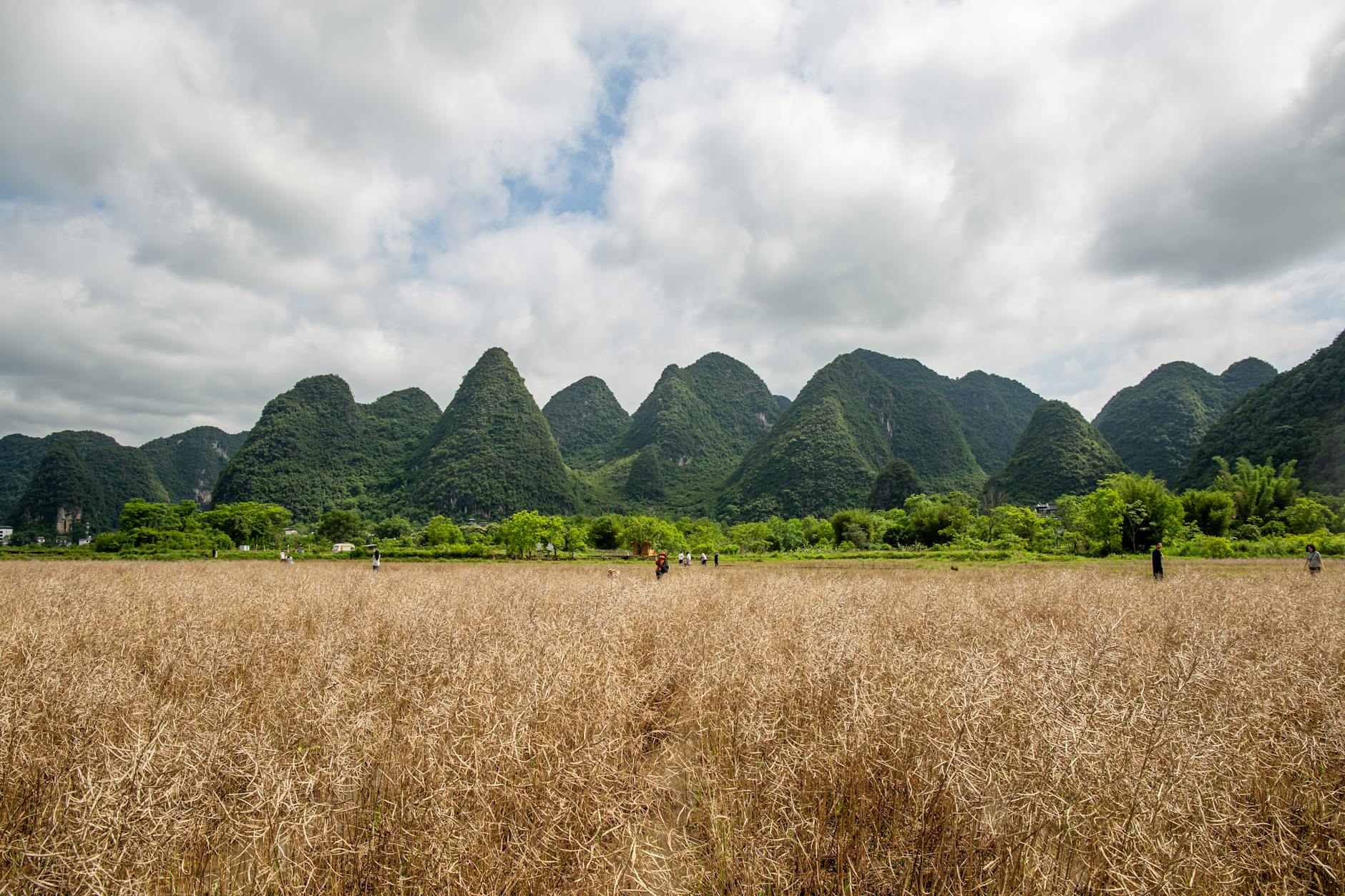
Xianggong Hill is a 250m peak overlooking the Li River’s tightest S-bend, near Xingping town. The view from the summit at sunrise (5:30-7 AM April-October) is one of THE iconic photos of Chinese landscape photography — Li River curving below karst peaks with mist filling the valley. Local photographers wake at 4 AM, hike 30 min to the summit, and shoot 100+ frames as the light shifts. Entry ¥80 (paid at the trail base). Closed at sunset for safety (no descent in dark). Best months April-November; foggy mornings give the painting effect.
Highlights
- Sunrise S-bend viewLi River’s most-photographed curve
- Cloud sea probability30-40% chance of mist between peaks on summer mornings
- 30-min hikeModerate uphill from Xingping base
What Chinese travelers actually do here
Distilled from Chinese-language travel notes — the practical tips most English guides miss.
- The view from Xianggong is the SAME composition as the ¥20 banknote, but ELEVATED — from 250m above. The banknote view is from river level at Xingping pier. Both are iconic but show different scales. Photographers shoot Xianggong at sunrise and the banknote view at golden-hour afternoon.
- Lens for the iconic shot: 70-200mm equivalent (telephoto compression brings the karst peaks closer to the river). Wide-angle 16-35mm captures the WHOLE valley including foreground rocks — works as an alternate composition.
- The summit has TWO main viewing platforms — the LOW platform (250m elevation, where 90% of tourists stop) and a HIGHER unmarked rock outcrop another 5 min above. The higher position gives a slightly steeper downward angle and significantly fewer people in your frame.
- Photographers from across China and Asia descend on Xianggong during ‘Golden Light Weeks’ (mid-October when sunrise mist + autumn light + low tourist count coincide). The summit can have 80-120 photographers on those mornings. Arrive earlier than 4:30 AM during this window.
- There’s NO food / water on the summit. Bring snacks and 500ml water minimum. The descent (40 min, downhill, daylight) is when most people get hungry/thirsty.
- If you’re staying in Xingping town, the BEST Xianggong access is via the ‘old back trail’ (locals’ shortcut) that starts behind the Xingping Hostel — bypasses the ¥80 entry gate. Tipping the hostel owner ¥20 for the tip is customary.
Photos
Watch creators visit Xianggong Hill
Each clip is timestamped to the moment the creator arrives at this stop.
Best Way to Spend 4 days in Guilin & Yangshuo
HOLIDAYING YOUR WAYStarts at 29:38
Xingping Ancient Town; Xingping Pier; Xianggong Mountain
Top 10 Best Things to Do in Yangshuo, Guilin, China [Yangshuo Travel Guide 2024]
Vacation IdeaStarts at 3:09
Xianggong Mountain
Videos


Frequently asked questions about Xianggong Hill
- When should I start hiking up to catch sunrise?
- Be at the trail base by 4:45-5 AM in summer (April-September); 5:30 AM in autumn (October-November). Hike is 30 min uphill at a steady pace. You want to be on the summit 15-20 min before official sunrise to claim a railing position and let your eyes adjust. Sunrise time varies — check the Yangshuo weather app the night before.
- How do I get to Xianggong Hill from Yangshuo town?
- It’s 35 km / 45-min drive from Yangshuo or 5 km / 15-min from Xingping town. Most photographers BASE in Xingping (¥150-300 hotels) specifically to access Xianggong for sunrise. From Yangshuo, you’d need a 4 AM departure — most hotels arrange pre-booked taxis (¥150-200 one way) the night before.
- What if it’s foggy or cloudy?
- Light fog between peaks = the BEST conditions (the painterly cloud-sea effect). Heavy fog (visibility <100m) = useless white wall, save your hike for another morning. Pure clear sky = decent photos but no atmosphere. The ideal: 30-40% cloud cover with mist clinging to the riverbed.
- Is the trail dangerous in the dark?
- Trail is well-maintained stone steps for most of the 30-min climb, but the final 100m has loose gravel. Bring a headlamp (phone flashlight works but ties up a hand). Don’t attempt off-trail shortcuts. Falls have happened in fog conditions; in clear darkness with headlamp, it’s a safe moderate-difficulty hike.
- Can I hike down at sunset instead?
- No — the trail closes at 18:00 for safety (descent in darkness is dangerous). Xianggong Hill is exclusively a SUNRISE attraction. The Li River S-bend looks best at dawn anyway because morning haze fills the valley; evening light shows the karst peaks but flatter atmospheric depth.
More in Guilin

Plan your Guilin trip
- Guilin vs Zhangjiajie — Which Karst Landscape Should You Pick?Itineraries · 8 min read
- China High-Speed Rail (Gaotie) — The 2026 Foreigner’s GuideTransit · 11 min read
- Does Google Maps Work in China? (No — Here’s What Does, 2026)Internet & Apps · 9 min read
- WeChat Pay for Foreigners — The 2026 Setup GuidePayments · 9 min read
- 240-Hour Visa-Free Transit to China — 2026 GuideVisa & Entry · 11 min read
- How to Use Alipay as a Foreigner in China — 2026 GuidePayments · 11 min read
- Do You Need a VPN for China? Legality, Setup Before You Fly, and What Breaks (2026)Internet & Apps · 13 min read